
Del Rio Neighbors Record Sources
The public trail around a Del Rio address begins with geography, then moves to records tied to a specific parcel. Del Rio GIS helps identify parcel shapes and nearby labels. Val Verde CAD provides the assessment-side owner, mailing, situs, and legal-description fields. The County Clerk’s official-records index adds recorded land instruments. These records identify distinct roles and dates, not every person who might be present on a Del Rio block.
| Source | What It Shows About a Block | Access and Privacy |
|---|---|---|
| City GIS Public Information or Planning Map | Parcel shapes, city limits, voting or planning layers, and related map context | Public map with an approximate, informational disclaimer |
| Val Verde CAD | Parcel or Geo ID, owner, mailing and situs fields, legal description, values, and exemptions | Public property fields; no occupancy guarantee |
| County official-records index | Conveyances, liens, plats, easements, and other instruments affecting lots | Free search and watermarked view; downloads or certified copies can charge |
| Texas voter workflow | Permitted registration information, status, VUID, and precinct context | Statutory request rules; protected fields and addresses are excluded |
| Explore Del Rio directory | Business and community contacts by keyword, category, A–Z, or ZIP | Public community directory, not a resident list |
| HOA certificate search | Association or management-certificate data when a local record exists | Public state certificates; no member roster confirmed |
Ownership and occupancy must stay separate. A CAD mailing address may be a post-office box, tax representative, trust, corporation, or address outside Val Verde County. A Del Rio GIS click identifies a parcel. It does not identify every neighbor, renter, guest, or household member connected with that location.
Mapping Del Rio Neighbors by Parcel
The adjacent-parcel method is a map-browse process, not a radius-search promise. Del Rio GIS links a Public Information Map and Planning Map, while CAD holds the assessment fields that help distinguish parcels. The City’s map disclaimer matters: boundaries are approximate and informational, not a legal survey. Use the map to orient Del Rio research, then verify the legal record with CAD and the County Clerk.
- Open the City of Del Rio public information or planning map and search or pan to the address. Identify the target parcel polygon and preserve the address exactly as the map shows it.
- Read the adjacent parcel labels or legal-description clues. Record each neighboring parcel or Geo ID separately because a street number can cover more than one lot or building.
- Run each identifier through Val Verde CAD. Keep owner, mailing address, situs, legal description, tax year, and exemptions in separate fields.
- Use the County Clerk index for recorded instruments after the parcel and legal description match. For a full named-street record chain, use the Del Rio street directory approach rather than treating a block map as a roster.
The Val Verde CAD property-search service is the public assessment entry point after a parcel has been identified.
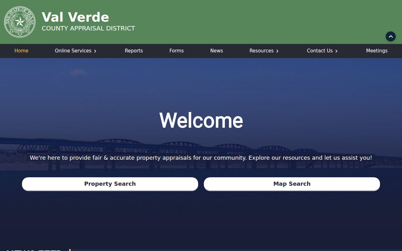
CAD’s exact current field labels, wildcard behavior, ZIP filtering, and pagination were not exposed in the research. Search a Del Rio owner, situs, account, or Geo ID only as the live service permits, and keep the displayed tax year with each result.
Del Rio Neighboring Geo IDs
A Del Rio Geo ID and legal description are steadier anchors than a loosely typed street line. CAD’s expected public record model includes property or account ID, Geo or map ID, owner name, mailing address, situs, subdivision, block, lot, neighborhood, values, exemptions, and taxing jurisdictions. Sample Val Verde identifiers include 5310-0030-0010 and 7010-0080-0010, but those examples show record structure, not a list of current neighbors.
For example, a Del Rio county packet’s older property print separates a Vega Verde situs from a post-office-box mailing address and records a block-and-lot legal description. Another example shows a Hunter Block C lot and adjacent map labels. Those fields illustrate why a mailing recipient and a person at the physical site cannot be treated as the same fact. A homestead exemption can be evidence consistent with owner occupancy, but it is not a guaranteed current residency finding.
- Parcel
- A tract or lot recognized in the assessment and map system. One street address can relate to multiple parcels or buildings.
- Situs
- The taxed parcel’s physical location. It is different from the address used to receive an appraisal or tax notice.
- Legal description
- The recorded land description, such as subdivision, block, lot, abstract, tract, or metes-and-bounds language. It is the bridge from CAD to an instrument search.
Del Rio Neighbors and Voter Data
A voter search is narrower than a Del Rio parcel map. Texas tools may help confirm registration status, precinct, polling place, or a VUID through the permitted workflow. A lawful voter-list request can include names, VUIDs, and allowed registration information. It does not turn the voter system into a block directory, and participation history does not reveal how anyone voted.
Texas Election Code sections 18.009 and 18.067 prohibit using voter information to advertise or promote products or services, with a Class A misdemeanor penalty. Protected addresses, Social Security numbers, and confidentiality-program records are excluded. The Texas Address Confidentiality Program and separate protected-voter procedures mean a missing name or address can be legally intentional.
Use the date. Registration status can change through confirmation, suspense, or cancellation procedures. Record the search date and treat the result as a limited status clue, not a permanent address finding.
Del Rio Community Directory Limits
Community sources can add context without supplying a household list. Explore Del Rio has keyword, category, A–Z, and ZIP filters, including Eat & Drink, Events, Services, Shop, Stay, and Things to Do. The results describe public business or community entries, not residents. City boards and commissions also publish civic contacts, agendas, and public information rather than private membership data.
| Public contact route | What the research confirms | What remains unavailable |
|---|---|---|
| Texas HOA management-certificate search | Searches association name, county, city, and ZIP and can open a certificate PDF | No confirmed Del Rio association record or member list was captured |
| Explore Del Rio | Public business and community contacts with category and ZIP filters | Not a resident or association membership roster |
| Val Verde County Historical Commission | Markers, cemeteries, documents, visitor guides, and research projects | No public resident-name database or Elks Hall membership roster |
| Val Verde County Library | Local service at 300 Spring Street and a branch at 315 E Chapoy | Directory, obituary, yearbook, and database holdings were not enumerated |
No neighborhood-association inventory, congregation roster, block-watch roster, or civic-club membership list appeared in the official city and county sources reviewed. Ask those organizations for public-facing contact or collection guidance, not private member data.
Del Rio Neighbor Records Compared
Different tools have different evidentiary weight. A public Del Rio map and CAD result are official, parcel-centered sources. The County Clerk index is the primary route for a recorded transfer. A compiled commercial neighbor tool may mix public filings, marketing data, phone histories, and other data, then retain duplicates or stale entries. Treat that category only as an unverified lead and return to the custodian for evidence.
| Record category | Best use | Key limit |
|---|---|---|
| GIS and CAD | Orient the block and identify assessment fields for each parcel | Neither is a survey, title opinion, or occupancy list |
| County Clerk instruments | Check recorded parties, dates, document types, and legal descriptions | Party names may be trustees, estates, lenders, or entities |
| Compiled commercial tools | Generate a question to verify with an official source | Can be wrong, stale, incomplete, or duplicated |
Parcel topology matters too. A road, alley, drainage channel, railroad, or undeveloped tract can separate lots that appear side by side at a broad map scale. A condominium or multi-lot tract may place several legal parcels under one street number. Keep one row per source event rather than one row per person.
Del Rio Neighbors and Old Maps
Historic material gives the block a date, not a current household list. The Library of Congress holds a 22-sheet Del Rio Sanborn run from 1930 through 1948. Those sheets show building footprints, street names, uses, and hazards. They do not name neighbors. Pair an old map with a dated deed, directory, census release, or newspaper only after the legal description and time period align.
Place labels can change independently. Records may describe the same area as Del Rio, San Felipe del Rio, a rural route, or Laughlin AFB. City limits, ZIP labels, precincts, and subdivision boundaries can also shift. Preserve the source’s original place wording beside a normalized modern label instead of silently replacing one with the other.
Del Rio Neighbor Lookup Privacy
No public Del Rio block search can identify every renter, household member, guest, child, roommate, utility customer, mail recipient, or current occupant. Delivery, utility, school, protected voter, and motor-vehicle information are not a general public block list. Texas Transportation Code Chapter 730 and the federal Driver’s Privacy Protection Act restrict motor-vehicle personal information.
A deed party, tax-mail recipient, voter, registered agent, historical directory entry, and current occupant are different relationships. Do not use a shared address to collapse those roles into an assertion about a living person. If a record appears wrong, contact the office that holds the parcel, instrument, or case record with the relevant identifier and correction evidence.
Lawful use. Del Rio neighbor research is for personal, lawful records research and community context. Do not use any record to stalk, harass, watch, threaten, or harm another person.