
Walk a Del Rio Street by Address
This street-by-street search begins with the physical address, but the first useful result is usually a parcel record rather than a household name. Enter the situs in Val Verde CAD, or find it on the City of Del Rio map, and preserve the account or Geo ID, legal description, listed owner, mailing address, and tax year as separate facts. The situs locates a taxed parcel. A mailing address is where a notice is sent and can be a post-office box, an agent, or a place outside the county.
For a Del Rio address, use the parcel identifiers to compare map, appraisal, and recorded-land evidence. A deed party may explain an ownership change, while a voter result can only provide status or precinct information within its own rules. Historical Del Rio directories and newspapers can add dated context, but they do not turn a current parcel result into a complete list of people at an address.
- Search the Del Rio physical address in Val Verde CAD and record the situs, Geo ID, and legal description.
- Pan along the same Del Rio street in the City GIS public-information or planning map and note the parcel context.
- Use the owner and legal description in the Val Verde County Clerk’s recorded-land index for Del Rio, checking both party roles.
- Compare an instrument’s legal description and recording date with the CAD record before connecting it to the parcel.
- For older context, keep a directory, newspaper, or voter result labeled by its own date and source.
Del Rio Street Parcel Fields
Val Verde CAD is the Del Rio starting point for an address search. The public service supports owner searching, and county examples show the record model a street researcher may encounter: account or property ID, Geo ID, owner, ownership share, situs, mailing address, subdivision, block and lot, values, exemptions, land and improvement lines, and taxing jurisdictions. The site capture did not expose the live required fields, wildcard behavior, or pagination, so this table identifies the documented field model rather than promising every control is currently visible.
| CAD field or mode | Format | Use on a Del Rio street | Verified limitation |
|---|---|---|---|
| Owner or business name | Text | Find the appraisal owner or entity | Exact wildcard behavior was not captured |
| Situs or property address | Text | Locate the physical parcel | Normalize directionals and suffixes |
| Property, account, or parcel ID | Text | Carry the exact ID between sources | Use the number displayed in the record |
| Geo ID or map ID | Text | Bridge a map to a parcel record | Sample IDs use four-digit hyphen blocks |
| City, ZIP, neighborhood, tax year | Filter | May refine a search | Live selectors require verification |
For example, county packet records show the Geo ID 7010-0080-0010 with the legal description VEGA VERDE BLOCK H LOT 1, a Rio Vista Dr. situs, and a Del Rio post-office-box mailing address. The packet is a dated appraisal example, not a deed or a current-residence statement. That distinction is central to a careful public-record trail.
The Val Verde CAD property-search page is the documented Del Rio source shown below.
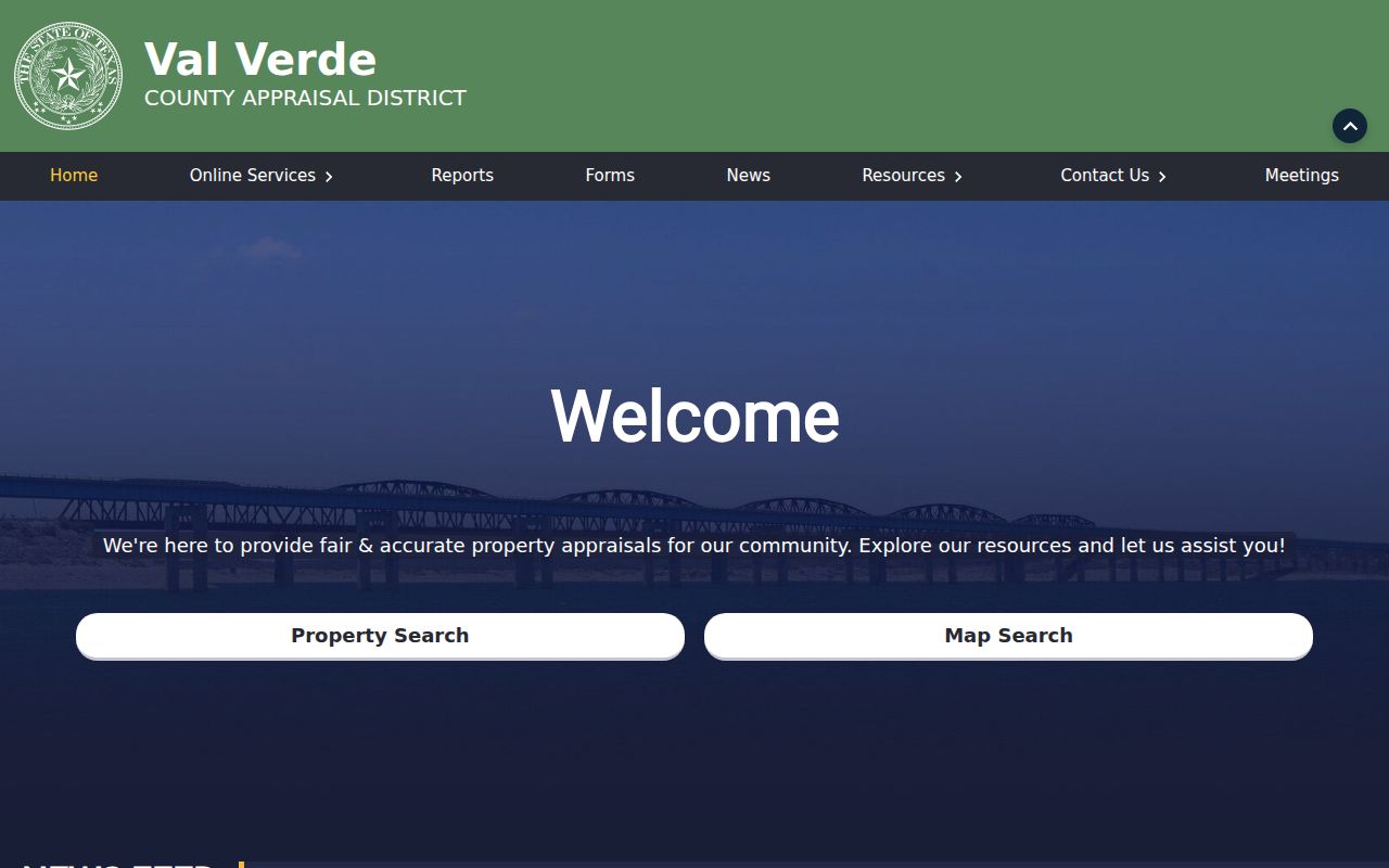
For a Del Rio parcel, the captured page is a practical entry point, while the exact screens and fields still need live confirmation before a narrow query is described as available.
Map a Del Rio Street Parcel
The City of Del Rio GIS offers Planning, Public Information, Weather, and Voting map products, plus city-limits, low-water-crossing, soil, and metes-and-bounds data. Use the maps to orient yourself along a street, identify the parcel polygon, and capture the parcel label or legal-description clues that lead back to CAD and the Clerk. The official disclaimer matters: these boundaries are approximate and informational, not a legal survey.
On a Del Rio map, a road, alley, drainage channel, railroad line, undeveloped tract, or a multi-lot parcel can make a nearby label misleading. A street-by-street record should therefore retain the map date and source URL, then treat a map click as an evidence transition, not a conclusion about title or occupancy. City map material can cover city-created geography; the County Clerk’s land records may cover county property with a Del Rio mailing address beyond the incorporated line.
Read Del Rio Street Descriptions
Del Rio street lines change form across records. A modern address may be missing from an older instrument even when the land is the same, because the deed is organized around a subdivision, block and lot, abstract, tract, acreage, survey, or metes-and-bounds call. The local examples HUNTER BLOCK C LOT 1, VEGA VERDE BLOCK H LOT 1, and Castle Canyon Estates Block 2 Lot 12 show why the legal description can be a stronger search anchor than a street string alone.
- Parcel
- A mapped unit of land used in the appraisal system. Its account or Geo ID helps connect CAD and map research.
- Situs address
- The physical location assigned to the taxed parcel. It is different from a mailing address.
- Plat
- A recorded map or plan that can describe subdivision lots, blocks, dedications, or easements.
- Criss-cross directory
- An address-arranged directory that can connect a historical address with a listed entry. No Del Rio-specific run was confirmed in the reviewed sources.
Use the original punctuation, directional, suffix, and unit mark first. Try N, North, St, Street, Dr, Drive, and unit variants only after comparing the parcel or legal description. There is no verified official Del Rio street-renumbering or renaming year, so a changed address form remains an unresolved mapping issue until plats, ordinances, or historic maps support the bridge.
Trace a Del Rio Street Deed
The Val Verde County Clerk’s official-records portal is the title trail for a Del Rio parcel, not CAD. Choose Recorded Land and begin with Name Search: the captured form has a required business or last-name field, an optional first-name field, and a Party Type choice of Both, Grantor, or Grantee. Once a broad result appears, narrow it with a recorded date, instrument number, volume, or document type. Compare the legal description in every result to the CAD parcel before treating it as part of the same street history.
In a Del Rio deed chain, search the current owner as grantee around the acquisition period, record the grantor, recording date, instrument number, volume or page, document type, and legal description, then search that grantor as a grantee for an earlier acquisition. Trustee, estate, corporate, spouse, correction, heirship, plat, release, lien, and easement records can explain a change without being ordinary sales. A certificate from the Clerk is the route when formal proof is needed.
The Val Verde official-records search supplies the documented name and party-type controls.
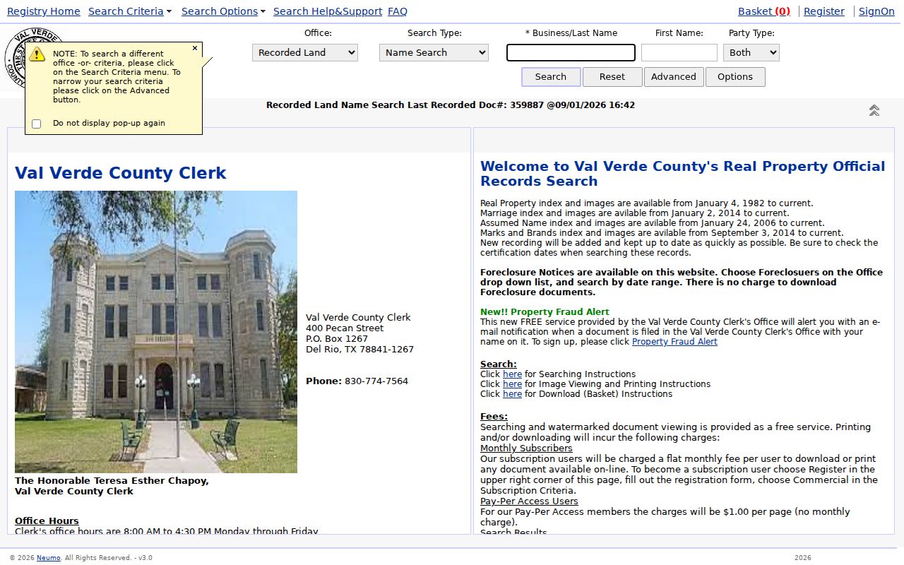
The portal supports free searching and watermarked viewing; printing, downloading, subscriptions, and certified copies can carry separate charges that should be confirmed with the Clerk.
Del Rio Street Records Since 1982
Val Verde County states that online land records for Del Rio research at TexasLandRecords run from 1982 to the present. That date is a documented online-access marker, not the first date land records existed or a promise that every earlier item is absent. When the chain reaches an earlier instrument, request a targeted lookup from the County Clerk using the legal description, approximate year, and both party names. Ask what is available as a plain copy, certified copy, volume and page citation, or onsite reference.
The index’s long document-type vocabulary also contains duplicate and abbreviated labels. Start with Search All Document Types and broad name and date choices rather than declaring a parcel clear because one guessed label returned nothing. This local quirk makes a street search more reliable when it preserves the actual query, party role, and record date beside every hit.
Del Rio Street Records
Each record set answers a different address question. CAD provides the appraisal view, GIS gives geographic orientation, and the Clerk index documents recorded instruments. The voter workflow can help with status or precinct under Texas rules, but it is not a street roster. No official public Del Rio permit index was found, so a permit or code request should be directed to the appropriate city office rather than implied to be searchable online.
| Address-keyed source | Local keeper | What it can show | Access boundary |
|---|---|---|---|
| Parcel and tax record | Val Verde CAD | Owner, mailing and situs fields, legal description, values, exemptions | Public service; not occupancy proof |
| Public map | City of Del Rio GIS | Parcel context, city limits, planning and voting layers | Approximate, informational map |
| Official-records index | Val Verde County Clerk | Instruments, party roles, legal descriptions, recording data | Free search and watermarked viewing; copy access varies |
| Voter status and lists | County Clerk and Texas voter tools | Status, precinct, polling information, permitted fields | Protected data and addresses are excluded |
| Permit or code material | City Development or Neighborhood Services | Potential construction or enforcement events | Public search and coverage were not verified |
The useful Del Rio chain is address to GIS parcel, CAD account, official-records instrument, and then dated historical sources. Do not skip the role labels. An owner, tax-mail recipient, grantor, grantee, voter, court party, and historical directory entry describe different relationships to the same street.
Del Rio Street Voter Context
Texas voter information is useful for a Del Rio status, precinct, or polling-place check, not for assembling a block list. The state FAQ identifies VUID, Texas driver’s-license information if provided during registration, and first and last name as search paths. The exact live validations and non-match wording were not captured. Val Verde County says voter-registration duties moved to the County Clerk effective August 24, 2026, with the local elections route at 400 Pecan Street.
A result does not reveal ballot choices, and a status can change. Protected addresses, Social Security numbers, and confidentiality-program records are excluded. If an address is part of the question, keep the search date and use it as a narrow verification clue only after independent parcel or record evidence supports the match.
The Texas voter-information guide outlines the available lookup choices.
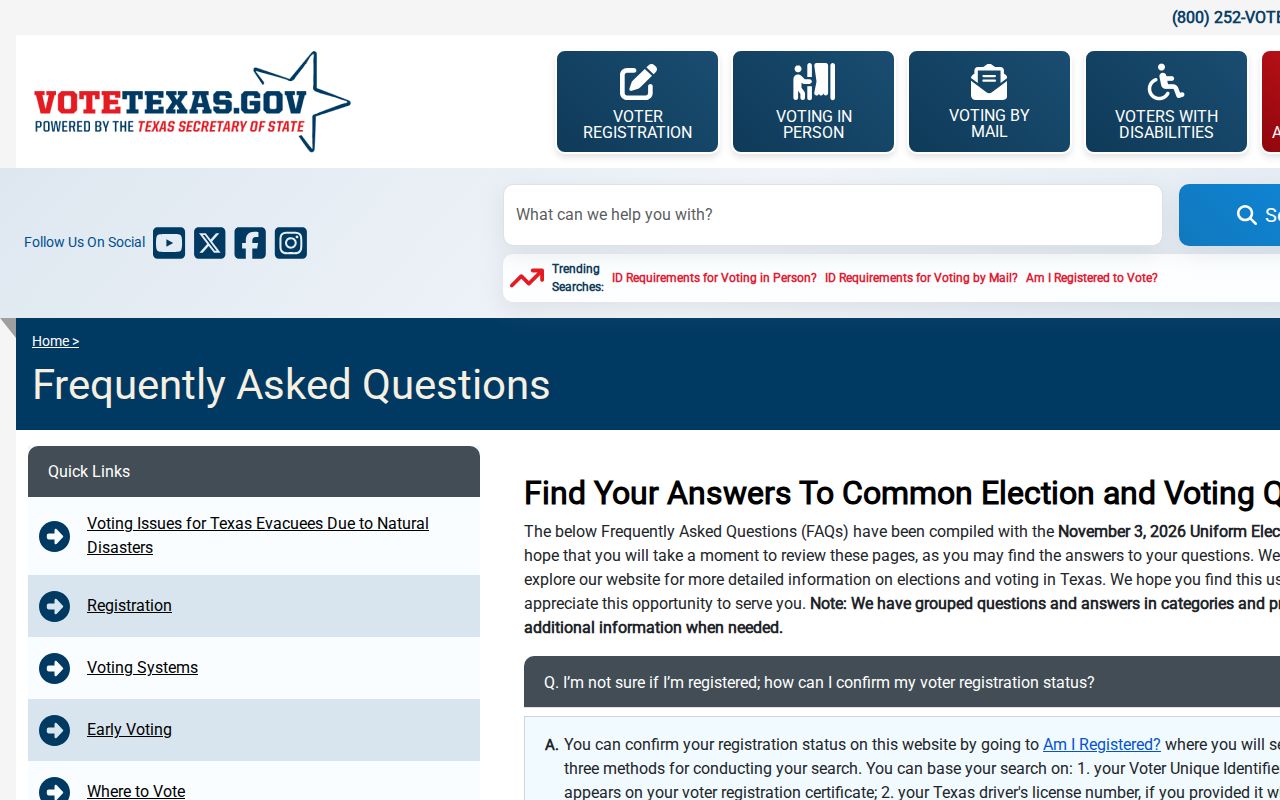
Use the state and county workflow to check an individual record carefully, then retain only the permitted result details and the date searched.
Search Del Rio Street Name Forms
Addresses may be printed as Del Rio, San Felipe del Rio, a rural route, or Laughlin AFB in different eras and sources. The city’s historical name was San Felipe del Rio until an 1883 post-office change shortened it to Del Rio. Preserve the place label as printed and add the modern label separately. For a street line, preserve the original direction, suffix, and unit information before testing variants.
Compound surnames, accents, paternal and maternal order, maiden or married names, initials, trustee names, and entity forms can matter when the address trail reaches the deed index. A zero result is a prompt to test the legal description or party role, not proof that no relevant public record exists. For a historical address, the city-directory page covers the dated collection path rather than assuming an unconfirmed reverse directory exists.
Limits of Del Rio Street Searches
A Del Rio parcel, map, or deed result cannot identify every person connected with a street address. Public sources may name an owner, a tax-mail recipient, a deed party, a voter, or a historical directory entry, but they are not a complete current-household list. Utility records, delivery records, school records, and protected voter data are not general public street data. DMV address information is restricted by federal and Texas law.
Use records with care. Keep street research focused on a lawful personal purpose, verify the result with its custodian, and do not use public information to stalk, harass, or harm anyone. An intentionally incomplete result can reflect a protected address or a source limit.
For a multi-unit location, search the base address, unit variations, owner name, and legal description separately. Record one row for each source event with the source address, normalized address, Geo ID, party role, date type, and confidence note. That method avoids turning a shared street line into an unsupported claim about a living person.
Finish a Del Rio Street Search
Stop a street-by-street chain when the next party cannot be located in the online index, the legal description no longer matches, or the Clerk confirms that the next record is book or microfilm material. Preserve the final matching instrument and state why the trail ends. Do not replace the gap with a same-name result, a modern address, or a map assumption.
If the question narrows to a historical address, use the nearest confirmed Del Rio directory years, Sanborn building maps, and newspaper material as separate dated sources. A Sanborn sheet may establish a building footprint or use, while a directory or newspaper can provide a name in its own time. The address trail is strongest when it leaves those layers distinct.